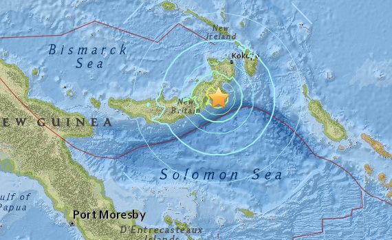
A 7.1 magnitude earthquake was recorded off the coast of the South Pacific island nation of Papua New Guinea.
The United States Geological Survey (USGS) reported the quake on Friday, occurring 66 miles south-west of the town of Kokopo in the north-east of the country.
No damages or casualties have yet been reported, and there are no signs of a tsunami approaching the coastline. The quake’s magnitude was later lowered to a 6.8 measurement by the USGS.

BYPASS THE CENSORS
Sign up to get unfiltered news delivered straight to your inbox.
You can unsubscribe any time. By subscribing you agree to our Terms of Use
Manchester Evening News reports:
The Pacific Tsunami Warning Centre said hazardous tsunami waves were possible within 186 miles of the epicentre, but the risk passed and the advisory was lifted.
There were no reports of damage or injuries, said Chris McKee, assistant director Geophysical Observatory in the capital, Port Moresby. The area closest to the epicentre is sparsely populated, and it was unlikely the quake caused any structural damage, he said.
There were also no reports of any tsunami sightings. Given the quake’s depth of about 37 miles, officials believed the risk of a tsunami was slim, said observatory official Mathew Moihoi.
Shallower quakes tend to cause more damage, and have a higher potential for generating a tsunami.
Papua New Guinea sits on the Ring of Fire, the arc of seismic faults around the Pacific Ocean where earthquakes are common.


